

Snappy Mapper - Alternatives & Competitors
Democratising Geospatial Data
Snappy Mapper simplifies spatial data collection for non-technical users, enabling field teams to create GIS-ready data without specialist tools or training.

Ranked by Relevance
-
1
 Mapit GIS Mobile GIS for asset collection, GPS surveys, and field data management
Mapit GIS is a professional mobile GIS platform for iOS and Android that enables offline-first data collection, GPS surveys, and field data management with support for GeoPackage, multiple export formats, and sub-metre GNSS accuracy.
- Other
-
2
 Mapline Geo-Powered Analytics and Mapping for Business Success
Mapline is a geo-intelligent analytics platform that empowers businesses to visualize, optimize, and manage location-based data through powerful mapping, routing, BI, and scheduling solutions.
- Free Trial
-
3
 NextGIS All-in-one GIS platform for maps and geodata
NextGIS provides comprehensive GIS solutions with web, mobile, desktop, and server tools for creating, managing, and sharing spatial data and interactive maps.
- Contact for Pricing
-
4
 Carta Maps Build Custom Interactive Maps with Ease
Carta Maps is an AI-powered platform for creating custom interactive maps with intuitive styling tools, real-time collaboration, and advanced features like geocoding, boundary finding, and drawing tools.
- Freemium
- From 9$
-
5
 MapMyGarden Garden management application - by gardeners, for gardeners!
MapMyGarden is an AI-powered garden management application that helps users plan and manage garden layouts using points, lines, and shapes while keeping track of plant and plot information.
- Other
-
6
 PolicyMap Comprehensive Mapping & Data Analytics For Smarter Decision-Making
PolicyMap is a cloud-based platform offering extensive data mapping, visualization, and analytics tools, empowering users to make impactful, data-driven decisions across sectors such as government, non-profit, finance, academic, and healthcare.
- Contact for Pricing
-
7
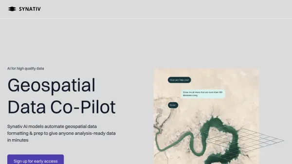 Synativ Geospatial Data Co-Pilot
Synativ utilizes AI to automate geospatial data formatting and preparation, delivering analysis-ready data in minutes. It significantly reduces manual labor and human error in geospatial data processing.
- Contact for Pricing
-
8
 SpatialPoint Location Intelligence for Powerful Business Decisions
SpatialPoint provides AI-powered location intelligence solutions including mapping, geocoding, address validation, and demographic analysis to solve complex business location challenges.
- Contact for Pricing
-
9
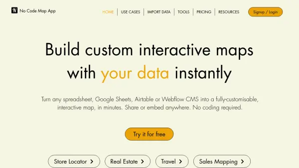 No Code Map App Build custom interactive maps with your data instantly
No Code Map App is an AI-powered platform that transforms spreadsheets, Google Sheets, Airtable, or Webflow CMS into fully customizable, interactive maps in minutes without coding, featuring automatic data sync and AI map styling.
- Freemium
- From 24$
-
10
 Terrain Navigator Pro Generating work flow efficiency and increasing return on investment for today’s mapping professionals
Terrain Navigator Pro is a comprehensive mapping platform that combines topographic maps and aerial photos with powerful mapping tools for creating, editing, and synchronizing map projects across desktop, web, and mobile devices.
- Free Trial
-
11
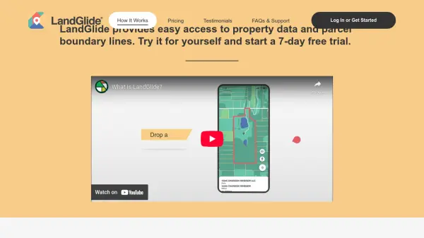 LandGlide Comprehensive Parcel Data and Property Line Mapping Anywhere
LandGlide offers advanced parcel data and property line mapping with GPS location, providing access to over 157 million U.S. parcel records on desktop and mobile devices.
- Freemium
- From 10$
-
12
 GeoComm GIS Solutions for Enhanced Emergency Response and Public Safety
GeoComm delivers advanced GIS mapping software and services designed to improve emergency response, school safety, and data management for public safety agencies and educational institutions.
- Contact for Pricing
-
13
 Maply Transform location data into powerful insights with intuitive mapping
Maply is an intuitive online mapping application that helps businesses and professionals visualize and analyze geospatial data through heat maps, network maps, route optimization, and other advanced mapping features.
- Freemium
- From 15$
-
14
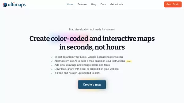 Ultimaps Map visualization tool made for humans
Ultimaps is an intuitive map visualization platform that allows users to create color-coded and interactive maps instantly by importing data from Excel, Google Spreadsheet, or Notion, with AI-assisted map creation capabilities.
- Freemium
- From 17$
-
15
 MangoMap Powerful, Affordable Online GIS Mapping for Professionals
MangoMap is an easy-to-use, cost-effective online GIS mapping platform designed for professionals who need robust mapping capabilities without the complexity or high licensing fees of traditional solutions.
- Paid
- From 79$
-
16
 Restoration Scope Custom data solutions for nature restoration
Restoration Scope builds data systems to support unique nature restoration projects, streamlining operations, increasing transparency, and accelerating fundraising through integrated data solutions.
- Contact for Pricing
-
17
 atlas.co Work with spatial data — simpler and faster
Atlas is a browser-based GIS platform designed to simplify the visualization, analysis, and building of spatial data workflows and web applications.
- Freemium
- From 23$
-
18
 Snap Surveys The complete survey solution for insightful feedback
Snap Surveys provides a comprehensive survey software platform, Snap XMP, for creating engaging surveys, analyzing data, and producing visual reports to drive actionable insights.
- Freemium
- From 30$
-
19
 Geospatial Cloud Serv Advanced geospatial data serving and microservices for comprehensive GIS solutions
Geospatial Cloud Serv provides a powerful self-hosted solution for advanced geospatial data serving, microservices, and APIs, compatible with various GIS platforms and mobile applications.
- Pay Once
-
20
 GeoDataSource Comprehensive World Cities Database for Developers and Businesses
GeoDataSource provides a comprehensive world cities database with 3 million city features across 249 countries, offering accurate location data including names, coordinates, and administrative divisions for integration into various database systems.
- Freemium
-
21
 SimpleCrew Field team management made simple
SimpleCrew is an accountability app that systematizes field team management using photos on a Google map, ideal for festivals, agencies, promoters, and contractors.
- Freemium
- From 19$
-
22
 MapTools Professional coordinate plotting tools for mapping and navigation
MapTools manufactures precision coordinate plotting tools for UTM, MGRS, USNG, and Latitude/Longitude systems, used by military, government agencies, and outdoor professionals worldwide.
- Other
-
23
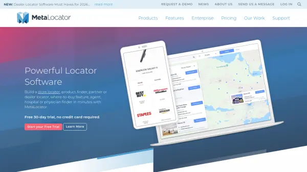 MetaLocator Powerful locator software to build store, dealer, and partner finders in minutes
MetaLocator is a comprehensive locator software platform that enables businesses to create store locators, dealer finders, and location-based search applications with over 300 features and a free 30-day trial.
- Freemium
- From 17$
-
24
 Snapt The Only URL Shortener You'll Ever Need!
Snapt is a comprehensive URL shortener tool designed for businesses, offering custom overlays, geo-targeting, branded links, and custom domains to enhance marketing campaigns.
- Other
-
25
 YouMap Create Social, Customizable Maps in Real-Time
YouMap is an interactive mapping platform that empowers users to create, customize, and share real-time maps on topics they care about, fostering community engagement and exploration.
- Free
-
26
 mapify.ai No-code platform to process real-time geospatial data and generate real-time insights
Mapify is a no-code platform that enables users to process real-time geospatial data, define business rules, and create interactive maps and applications for IoT and location-based solutions without coding.
- Free Trial
-
27
 Tile38 Ultra Fast Geospatial Database & Geofencing Server
Tile38 is an open-source geospatial database and geofencing server that delivers real-time location-based notifications and high-performance spatial indexing for applications.
- Other
-
28
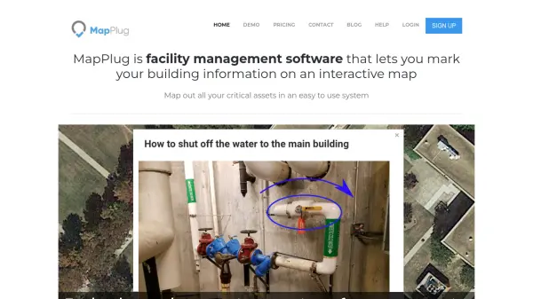 MapPlug Facility management software that lets you mark your building information on an interactive map
MapPlug is a cloud-based facility management software that enables users to document building assets, floor plans, and emergency procedures on interactive maps for improved property management and emergency response.
- Freemium
- From 49$
-
29
 SphereHunt Your Go-To Real-Time, Location-Based App
SphereHunt is a real-time location-based app that enables users to publish reports, receive instant local alerts, and engage with their community through an integrated map and chat features.
- Free
-
30
 Geographyquiz.app Master Geography Through Interactive Learning Games
Geographyquiz.app offers over 400 high-quality, interactive geography quizzes covering countries, capitals, cities, rivers, and more, making it the ideal resource for learning about the world. Users can explore quizzes on global, regional, and country-specific topics and improve their knowledge in multiple languages.
- Free
-
31
 inAtlas Faster and easier business decisions
inAtlas is a Big Data and Location Intelligence company that transforms geospatial data into valuable information for business growth, specializing in new client acquisition and expansion solutions worldwide.
- Contact for Pricing
-
32
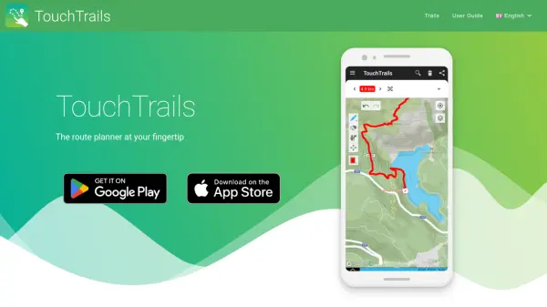 TouchTrails The route planner at your fingertip
TouchTrails is an AI-powered route planning tool that enables users to create, track, and navigate trails for hiking, running, and cycling with intuitive map-based drawing and GPX file support.
- Other
-
33
 Survtapp Intuitive Survey Software for Online and Offline Data Collection
Survtapp is a comprehensive survey software offering powerful online and offline data collection tools for customer feedback, lead capture, employee engagement, and market research across web, iOS, and Android platforms.
- Freemium
- From 99$
-
34
 Snaptrends Location-based social media insights for global brands
Snaptrends is an AI-powered social media software that provides real-time location-based customer insights by analyzing social media content across specified geographic areas, helping organizations enhance their brand, service, or product.
- Contact for Pricing
-
35
 Agri Tracking Systems Comprehensive farm management and tracking platform for California agriculture
Agri Tracking Systems provides a comprehensive farm management platform with real-time mapping, crop management, irrigation tracking, compliance reporting, and team collaboration tools specifically designed for California agriculture.
- Contact for Pricing
-
36
 Acclym Transform on-ground data into actionable sustainability insights
Acclym offers field-to-dashboard solutions for food and beverage companies, converting data into sustainability and supply chain intelligence to streamline reporting, compliance, and impact tracking.
- Contact for Pricing
-
37
 Geospatial Analytics Real Estate Decision Intelligence Software
Geospatial Analytics delivers advanced real estate management technologies and analytical platform solutions, enabling portfolio optimization and informed decision-making through data-driven insights.
- Contact for Pricing
-
38
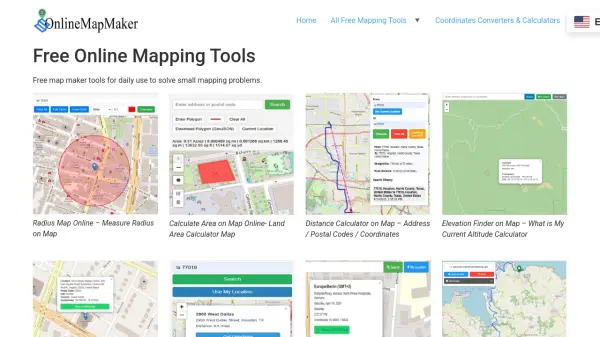 Online Map Maker Free, Easy-to-Use Online Mapping and Geodata Tools
Online Map Maker provides a suite of free web-based mapping tools for calculating areas, distances, elevations, zip codes, and more through an intuitive interface. The platform supports geographic data visualization, conversion, and analysis for students, professionals, and planners.
- Free
Didn't find tool you were looking for?