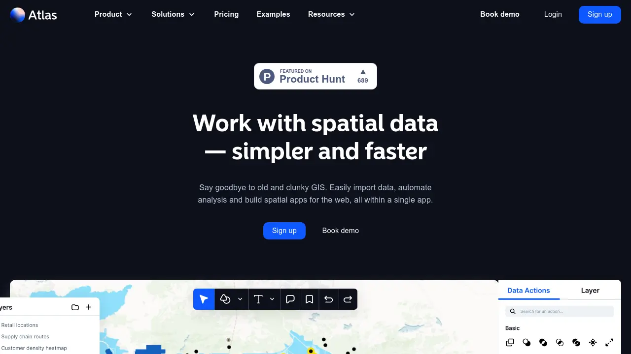
What is atlas.co?
Atlas offers a streamlined approach to Geographic Information Systems (GIS), enabling users to work with spatial data more efficiently. This browser-based platform allows for easy data import from various sources, supporting over 20 file formats including CSV, GeoJSON, KML, and Shapefile. Users can also enrich their datasets by querying open data sources like OpenStreetMap or connecting directly to WMS, WMTS, and XYZ servers.
The platform emphasizes ease of use, making advanced spatial analysis accessible even without prior GIS expertise. It provides tools for visualizing location-based data through maps, heatmaps, and other representations. Furthermore, Atlas facilitates the automation of analysis and the creation of spatial applications for the web, all within a single integrated environment designed for collaboration and sharing.
Features
- Broad Data Import: Supports 20+ file formats including CSV, GeoJSON, KML, and Shapefile.
- Open Data Integration: Query data from sources like OpenStreetMap and Overture.
- Server Connectivity: Connect to WMS, WMTS, and XYZ servers for remote dataset access.
- Simplified Spatial Analysis: Perform over 50 types of advanced GIS analyses without expert knowledge.
- Web App Builder: Create spatial applications directly within the platform.
- Data Visualization: Tools for creating maps, customer density heatmaps, and visualizing routes or zones.
- Collaboration Workspaces: Shared spaces for projects, files, basemaps, and palettes.
Use Cases
- Mapping customer locations and densities.
- Optimizing sales territories.
- Conducting market analysis and identifying opportunity zones.
- Visualizing supply chain routes.
- Analyzing real estate and infrastructure data.
- Mapping climate risk and sustainability factors.
- Supporting public service administration tasks.
- Sharing interactive maps publicly or privately.
FAQs
-
What kind of companies use Atlas?
Atlas is used by companies of all sizes, from startups to large enterprises across various industries like retail, real estate, energy, and more. Sales, marketing, and operations teams utilize it wherever location data influences decisions. -
Who on my team should use Atlas?
Atlas is designed for anyone working with location data, including sales teams, marketing teams, operations teams, analysts, and anyone needing to visualize and analyze geographic information. -
What is a workspace in Atlas?
Workspaces are designated areas within Atlas for sharing projects, files, basemaps, and color palettes among a group. Users can create and join multiple workspaces to facilitate cross-functional work. -
What kind of support does Atlas provide?
Support is available via email (help@atlas.co) Monday through Friday, excluding company holidays. Phone or live chat support is not offered. -
Can I share my maps publicly?
Yes, while projects are private by default, they can be shared publicly via links. This is useful for sharing with external stakeholders or colleagues without an Atlas account. -
Do viewers of my shared maps need a separate plan?
No, Atlas offers unlimited free commenters and viewers for publicly shared maps across all plans.
Related Queries
Helpful for people in the following professions
atlas.co Uptime Monitor
Average Uptime
99.67%
Average Response Time
210.38 ms

Featured Tools
Join Our Newsletter
Stay updated with the latest AI tools, news, and offers by subscribing to our weekly newsletter.