ReddRadar

What is Synativ?
Synativ offers a platform where AI agents address and rectify critical data issues within the geospatial industry. By automating the traditionally manual processes of data formatting and preparation, it minimizes human error and enhances efficiency.
The platform facilitates a streamlined workflow, allowing users to easily connect their data sources or upload datasets directly. It offers instant identification and correction of formatting issues, duplicates, and topology errors through a user-friendly chat interface.
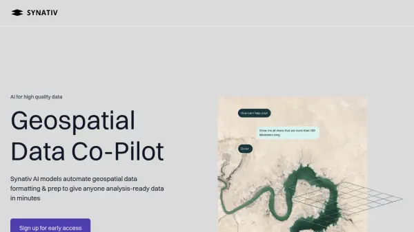
Features
- Data Connection: Easily connect data sources or upload geospatial datasets.
- Chat Interface: Query data using a chat interface.
- Formatting & Field Data Correction: Automatically identifies and fixes formatting issues.
- Duplicate Removal: Detects and eliminates duplicate entries.
- Topology Error Correction: Resolves topology errors within the data.
Use Cases
- Geospatial data cleaning and preparation
- Data migration in geospatial projects
- Location intelligence data processing
- GIS data management for utility companies
- Geospatial data analysis for engineering firms