ReddRadar
What is Mayday.ai?
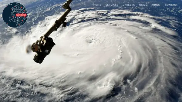
Mayday.ai offers comprehensive global intelligence focused on risk, disaster management, and environmental monitoring. It utilizes a sophisticated AI fusion engine that processes data from a wide array of sources, including over 300 GEO and LEO satellites and 35,000 AI-enabled cameras, to deliver real-time insights. The platform is designed to meet the demanding standards of governments, humanitarian aid organizations, first responders, and corporate clients, shifting the focus from reactive measures to proactive risk reduction.
The system provides unprecedented visibility into evolving situations, detecting events as they occur and presenting them through a common operating picture for coordinated responses. Mayday.ai supports the integration of proprietary data layers, such as CCTV feeds for site-specific monitoring, and offers features like mobile applications for communication and community-centered feeds. Its capabilities extend to dynamic risk modeling for the insurance industry, environmental hazard detection, impact assessment, and prescriptive analytics for environmental planning, aiming to democratize access to critical intelligence.
Features
- AI Fusion Engine: Integrates diverse data sources (satellites, cameras, user data) for real-time event detection.
- Global Satellite Monitoring: Utilizes over 300 GEO and LEO satellites with frequent updates.
- AI-Enabled Camera Integration: Leverages 35,000+ cameras including traffic and infrared.
- Common Operating Picture: Provides a unified view for situational awareness and coordination.
- Real-time Event Detection: Identifies climatological, geophysical, hydrological, biological, technological, and human-made disasters as they happen.
- Site-Specific Monitoring: Allows focused monitoring of industrial sites with proprietary data integration (e.g., CCTV).
- Dynamic Risk Modeling: Offers granular, up-to-date risk modeling for industries like insurance.
- Environmental Hazard Detection: Monitors environmental standards and detects hazards in real-time.
- Mobile App & Communication: Includes mobile apps with two-way communication and check-in features.
- Forensic Analytics: Provides in-depth analysis using high-resolution imagery and drone data.
Use Cases
- Assisting governments and first responders in disaster management and risk reduction.
- Enabling enterprises to monitor global sites, protect assets, and manage supply chain risks.
- Providing insurers with dynamic risk modeling, asset integration, and rapid damage assessment tools.
- Supporting environmental agencies with real-time hazard detection, impact assessment, and planning.
- Implementing the Sendai Risk Framework through proactive risk intelligence.
- Facilitating smooth insurance claim processing, especially in areas with limited infrastructure.