ReddRadar
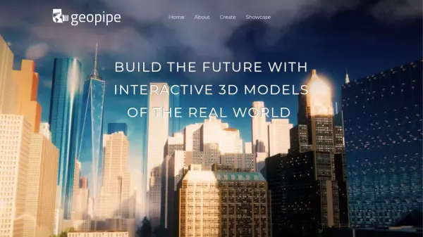
What is Geopipe?
Geopipe leverages proprietary artificial intelligence and machine learning pipelines to transform raw sensor data, such as photos and laser scans, into rich, interactive 3D models of real-world locations. The AI identifies objects within cities and rapidly reconstructs detailed digital twins at various levels of detail.
This platform allows users, including game developers, architects, and VR artists, to access pre-reconstructed regions instantly. Users can integrate these immersive environments directly into their projects using tools like Unity3D and Unreal Engine, or by downloading 3D meshes, significantly reducing the time and effort required for creating realistic settings for games, simulations, and virtual reality experiences.
Features
- AI-Powered Reconstruction: Uses AI and machine learning to process sensor data and build 3D models.
- Real-World Digital Twins: Creates rich, detailed digital replicas of cities and environments.
- Multiple Levels of Detail: Reconstructs models at various detail levels for different needs.
- Instant Access: Pre-reconstructed regions available for immediate download or streaming.
- Engine Integration: Supports direct use in Unity3D and Unreal Engine.
- 3D Mesh Export: Provides models as standard 3D meshes.
Use Cases
- Developing games set in realistic real-world locations.
- Creating immersive simulations for training or analysis.
- Building virtual reality experiences based on actual cities.
- Architectural visualization and urban planning.
- Rapid environment creation for indie and AAA game studios.