 ReddRadar

Planet Uptime Monitor
AI-Powered Earth Intelligence for Global Monitoring and Decision Making
Last 30 Days Performance
Average Uptime
0%
Based on 30-day monitoring period
Average Response Time
0ms
Mean response time across all checks
Daily Status Overview
Hover for detailsRelated Uptime Monitors
Explore uptime status for similar tools that also have monitoring enabled.
-
 Operational
Overview
Satellite and aerial imagery revealing Earth's transformation
Overview uses satellite and aerial imagery to showcase how human activity and natural forces shape our planet, offering a powerful perspective on civilization and the environment.
Last checked: 1 month ago View Status -
 Operational
Spectator
Live Satellite Monitoring and Centralized Data Access
Spectator is an AI-powered platform that provides seamless access to Earth observation satellite data from programs like Copernicus Sentinels and USGS/NASA Landsat, offering daily fresh satellite images, high-resolution commercial imagery, and flexible tools for tracking satellite passes and scheduling imaging.
Last checked: 1 month ago View Status -
 Operational
Mayday.ai
Global Risk, Disaster, and Environmental Intelligence Platform
Mayday.ai provides real-time global risk, disaster, and environmental intelligence using an AI fusion engine, leveraging satellite and camera data for governments, enterprises, and insurers. It aids in risk reduction, disaster management, and environmental monitoring.
Last checked: 1 month ago View Status -
 Operational
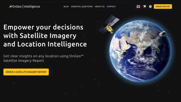
OnGeo Intelligence
Empower your decisions with Satellite Imagery and Location Intelligence
OnGeo Intelligence provides AI-enhanced satellite imagery reports with global coverage, delivering clear PDF insights and data packages for various professional applications without requiring technical skills or subscriptions.
Last checked: 1 month ago View Status -
 Operational
Picterra
Reliable GeoAI solution for sustainability, compliance, transparency, accountability, monitoring, and verification.
Picterra is a GeoAI platform that enables users to build and deploy custom AI models for geospatial imagery analysis. It supports various data types and offers solutions for multiple industries, facilitating scalable and collaborative geospatial analysis.
Last checked: 1 month ago View Status -
 Operational
FlyPix AI
Geospatial AI Platform for Analyzing Earth's Surface
FlyPix AI is a geospatial analysis platform that uses AI to detect and analyze objects in images. Train custom AI models and analyze geospatial data tied to coordinates.
Last checked: 1 month ago View Status